I’m hopeless with maps and have dreadful memories of getting terribly carsick while trying to use them to navigate from the passenger seat of hire cars. They still make me motion sick when I even think of them. Except for this pretty little gem that I stumbled upon on my most recent trip to Lucerne.

One good aspect of this treasure map is that there is no driving involved. It’s all about walking around a beautiful lake.
My motto is: walk more, eat more. I knew I’d eat a lot of Swiss cheese and chocolate in Lucerne so I already had a plan to walk right around Lake Lucerne before I found the map at the local Information Centre.
The map covers two hiking paths; 98 and 99, and breaks this epic journey into nine sections, each taking around five hours to complete. I cheated, of course, and did it in smaller chunks, and leaving a few gaps for future Lucerne visits.
Here’s how I did it:
Day 1: The Swiss Path, or route 99 from Rutli to Fluelen will take around 5 hours and 30 minutes according to the lovely map. I caught a train from Lucerne to Fluelen which took about an hour. Then I walked from Fluelen to beautiful Bauen which took around 2 hours and 20 minutes.
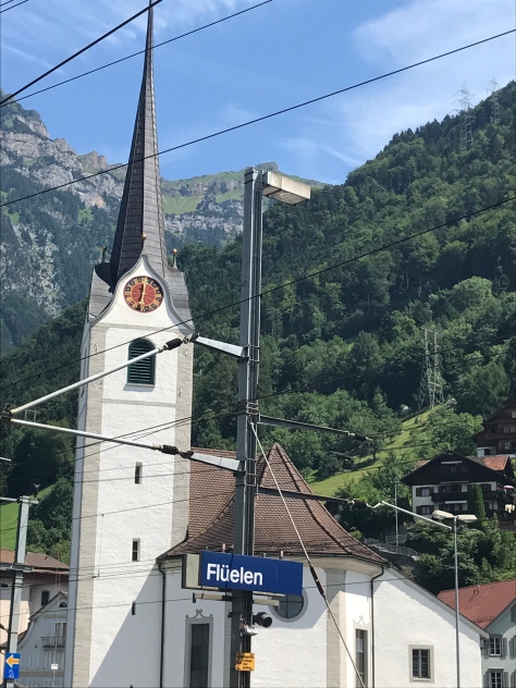
There’s plenty of signage including the yellow Wanderweg signs that specify the route number, in this case 99.

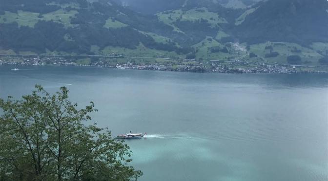
This route passes the Reuss Delta where I saw artificial bathing islands and little picnic spots. I passed through a long tunnel, through the base of a mountain, with peep-holes along the way.
A picnic is essential and I enjoyed it during a tropical rain storm under a small timber shelter next to the lake.


Bauen is a beautiful, small village with the prettiest cemetery you’ll ever see.

Conveniently it also has a ferry stop with regular boats returning to Lucerne.

Day 2: The Waldstaetterweg or route 98 says that Alpnachstad to Bürgenstock will take 5 hours and15 minutes. Then Bürgenstock to Beckenried will take around 4 hours and 45 minutes. These both involve mountains and cliff paths with spectacular views but also lots of hard work. So I combined the two stages and took the easy way which involved my friend Debbie driving me to Bürgenstock then walking along some pretty mountain paths.
It also involved taking an elevator unlike any other.

The Hammetschwand lift is located at an altitude of 1,132 metres, and is the highest outdoor elevator in Europe. It was built 111 years ago and makes the 152-metre vertical run in less than a minute.

The view from the top is spectacular. Oh, and there’s a small restaurant at the top where I bought a Swiss sausage and a beer.

Day 3: Lucerne to Alpnachstad is stage 4 of route 98 and has an estimated hiking time of 6 hours, 30 minutes. I started walking from Debbie’s house in Lucerne and walked for around 4 hours before catching a train back from Hergiswil.
Only ten minutes from the centre of Lucerne I came across small farms and contented cows.

Interspersed with the farms were interesting Swiss-style houses and the occasional ancient frieze.


The Seehotel at Kastanienbaum marked the start of a leisure stretch of the lake.

Small grassy ‘beaches’ punctuated this stretch and food vans provided the opportunity for sustenance along the way.

The end of this walk for me was in Hergiswil where there is a glass factory with glass blowing demonstrations, a glass museum and a glass maze. I was given cloth slippers and white gloves and told to feel my way through the maze. I love all things glass which made this destination a favourite.

Day 4 and 5: Lucerne to Küssnacht should take around 4 hours and 30 minutes but I did it from either end over two days; first walking to Meggen then taking a boat from Lucerne to Küssnacht, walking in one direction, then the other and catching the boat back to Lucerne.
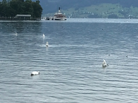
The first stretch is along the lake where there’s always lots to see. I love watching the swans with their bottoms in the air.
Then there’s a bit of a hike up green hills before dropping back down to Meggen ferry stop.

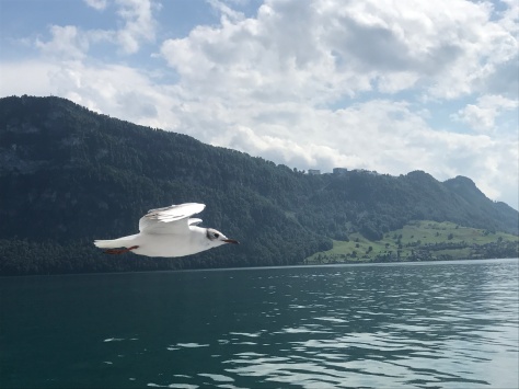
Küssnacht is a pretty town with lots of farms and William Tell’s castle. I was accompanied on the boat trip home by curious water birds encouraged by tourists throwing crumbs in the air.
Day 6: This was my favourite. I combined Stage 1 and 2 of route 98. Brunnen to Vitznau should take around 4 hours and 45 minutes and Vitznau to Küssnacht will take an estimated 5 hours, 45 minutes. I had already spent lots of time around Küssnacht so I took a boat straight to Gersau and started walking to Vitznau.

There are three ways to walk from Gersau to Vitznau; along the lake which is pretty but involves bitumen roads, a steep mountain path with spectacular views and a moderate, not-quite-so-steep mountain path also with wonderful views. Guess which one I took?
The moderate path was delightful and featured goats with bells around their necks and a few Heidi houses.


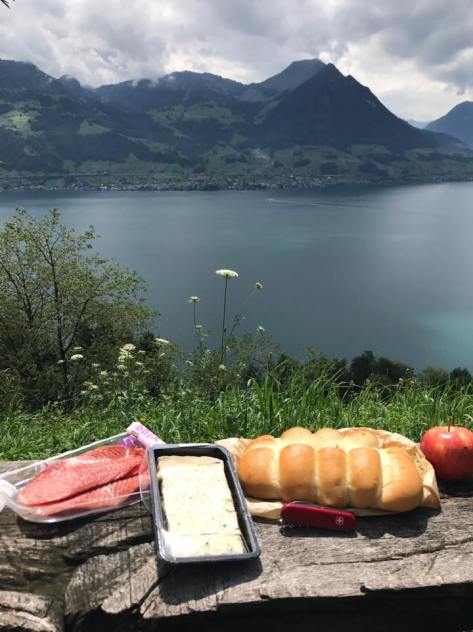
I stopped half way, which happened to be the highest point on the path, for a picnic with a view.
The town of Vitznau lies at the foot of Rigi mountain. It has two, stunning lake front hotels, one of which, Vitznaur-hoff, holds special significance for me.

It has a lakeside terrace that resembles something I’ve seen in George Cluny movies and, fortuitously, I arrived there at apero – Swiss for ‘happy hour’.

You can find my favourite map at the Information Centre in Lucerne, or check the corresponding websites, each with current information on accomodation and places to eat as well as photos and useful tips on each area along the Swiss hiking paths.
The Waldstaetterweg or route 98.
The Swiss Path or route 99.
http://www.weg-der-schweiz.ch/de/ which has an option to read in English as well as German.

